Avalanche Weekly Summary - April 17, 2025
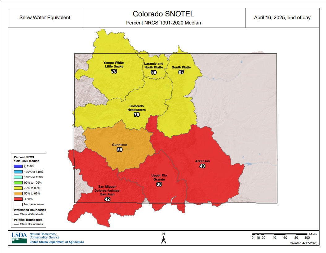
Colorado experienced a warm, dry, and mostly sunny week, accelerating our transition into spring conditions. The snowpack continued to diminish: valley bottoms are unusually dry for this time of year, and many SNOTEL sites are showing below-average Snow Water Equivalent. In the Southern Mountains, most sites have dropped below 50% of the 30-year median SWE.
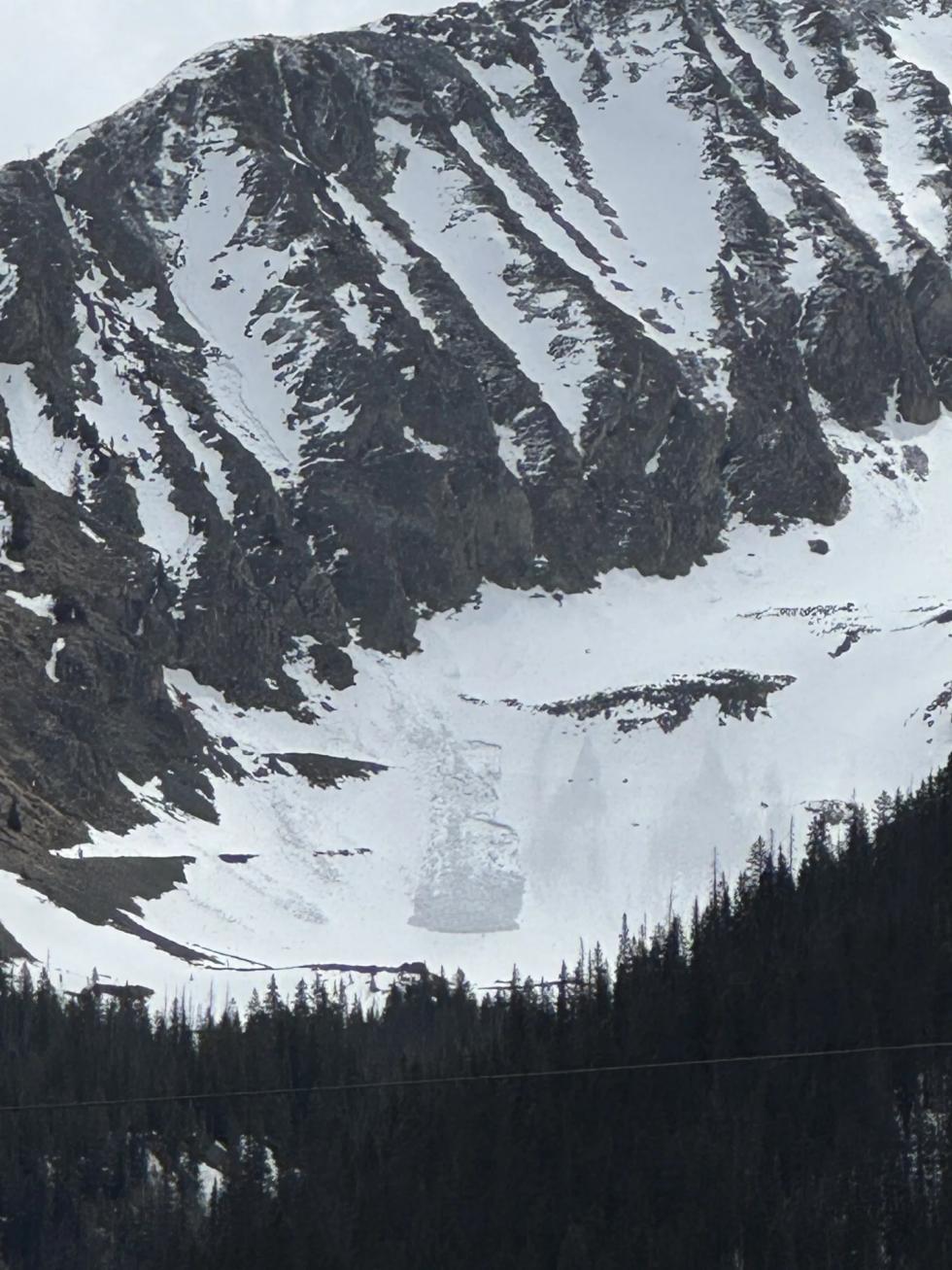
After near-record highs last weekend, temperatures dropped closer to seasonal averages during the week, with decent overnight freezes helping to limit wet avalanche activity. In the past week, only 43 avalanches were reported—mostly small Loose Wet avalanches, with a few cornice falls and Wet Slabs. The most notable event was a large Wet Slab in the Tenmile Range that caught, carried, and injured a skier
By Thursday, increasing winds and falling temperatures signaled the approach of a storm system, temporarily easing wet avalanche concerns. The storm arrives Friday into Saturday and will bring a return to winter-like conditions in the high country. While snowfall totals likely won’t be enough to produce widespread Storm Slab avalanches, fresh wind slabs will develop at upper elevations. These will be small but easy to trigger, posing a serious risk in steep, high-consequence terrain. Once the storm clears and temperatures rise, we expect a rapid Loose Wet avalanche cycle and a renewed potential for Wet Slab avalanches on previously shaded slopes.